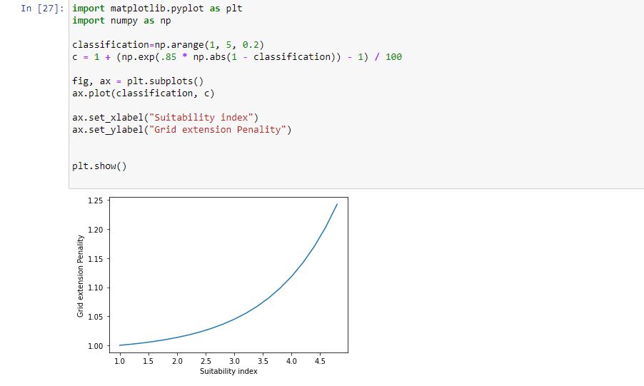
I am working on projects on OnSSET. I tried to understand how the grid extension penalty ratio is calculated by taking into account the geospatial datasets. However, I found it difficult to understand why the grid penalty ratio also increases when the suitability increases. Shouldn’t it be the other way around? I have attached the code that I took from OnSSET and plotted it.
OnSSET uses the inverse classification when determining the grid penalty (so one of your axes should be inverted in the plot, 5 is the worst classification and 1 is the best).